Contact Information
Countywide Planner – Countywide Planning Team
Email: planner@plancom.org
Phone: 813-272-5940
To view the Balm Community Plan (Effective June 28, 2013) please click the link below and use the Table of Contents.
View the Sociocultural Data Report (SDR) for Balm. The SDR contains demographic information and trends for Balm from 1990 to 2015, a summary of existing land use within the community, and a list of facilities. A demographic profile for Hillsborough County is also available at the end of the document.
About the Plan
Plan Status
Amendments
About the Plan
Balm is a small rural community in southeast Hillsborough County that dates back to the late 1800s. The town is centered at the intersection of Balm Wimauma Road, Balm Road, and County Road 672, and extends into the surrounding countryside.
History suggests that Balm received its name when the area needed to open a post office. Someone had looked out at the beautiful, calm country side and decided upon the name Balm. The name was officially established on June 7, 1902.
Around this time, the Seaboard Air Line Railroad began a route from Bradenton to Turkey Creek. H.S. Hicks had sold his property along the railway in order to have a station built in the community and Harley D. Sweat established a general store across from the new train station. Soon after, Balm became a daily flag stop along the route. Trains could be flagged down, but often would ride through collecting mail that was hung on a hook at the station, and deliver mail by throwing mailbags off the side.
Harley D. Sweat’s general store became a focal point of the community along with the first church, Balm Missionary Baptist, which was founded in 1913 and is still active today. Balm’s first school, Sand Hill School, aptly named for its elevated location, ran on a “strawberry school” schedule from April until December. However, Sand Hill School soon closed, and another school opened across from the church called Balm School. This school also closed shortly thereafter. Today, there is no local school within Balm.
Hearty pioneer families had been calling Balm home even before its establishment. Some of the very first settlers included family names such as Burnett, Sweat, Colding, Sumner, Capps, Davis, Dupree and Collins. These self-sufficient families farmed and ranched for a living. They grew their own crops, including strawberries, potatoes, citrus, sugar cane, and vegetables. They raised and butchered their own meat, otherwise hunting and fishing for their food. They built their own houses, made their own clothes, and looked out for each other, neighbor helping neighbor. As one of the oldest residents recalls, “You learned to make do. You made ends meet. You made the most out of whatever you had. If you had no milk for your biscuits, you used grapefruit juice instead. If you tried and worked, you could find what you needed.”
Farming at the time was enough to support Mays Packing industry which shipped from Balm, Plant City, and Seffner. Other than farming, the Balm community supported a blacksmith, a notary, and the general store. By 1925, the town’s population had grown to 250 people. Around 1937, electricity was introduced to Balm. Telephone service followed shortly thereafter. The first phone was located in the county road barn and acted as a community phone. Aquaculture, or tropical fish farming, began in the area around the early 1960s and is still an important part of Balm’s economy.
World War II brought many changes to Balm and some people left their farms to work in larger towns. Nonetheless, Balm has retained much of its rural and agricultural character and small-town feel. These traits are valued by its citizens, both the descendants of the original pioneer families and those families who have joined them in calling Balm home.
Plan Status
Currently in the Plan Amendment Process.
Amendments
Documents
Please Click on the Following Links to download Documents and Meetings relating to this community Plan.
Maps
Please Click on the Following Links to download Maps relating to this community Plan.
Maps
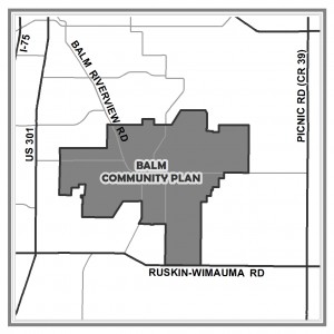
Balm Community Plan Boundary Map
Balm Community Plan Subdivisions and Neighborhood Boundaries
Balm Community Plan Adopted Future Land Use
Balm Community Plan Points of Interest
Graphics
There are no current graphics for this plan.