 August 2020 – Approximately 140 rarely seen geo-referenced aerial photographs are now available to researchers and the general public via a new Planning Commission story map. The Oblique Aerials Browser provides access to high-resolution Tagged Image File Format (TIFF) images documenting Tampa’s changing post-war urban landscape prior to the development of the 1960s.
Many of these photographs were taken under the auspices of the City of Tampa’s Planning and Zoning Board, the predecessor to the Planning Commission. In fact, the same legislation that established the Planning Commission also abolished the City of Tampa’s Planning and Zoning Board. Its assets, including these photographs, were transferred to the Planning Commission. Although digitized by the Special Collections Department at the University of South Florida in 2006, it was only recently that a suitable technology was developed to geo-reference and disseminate these images.
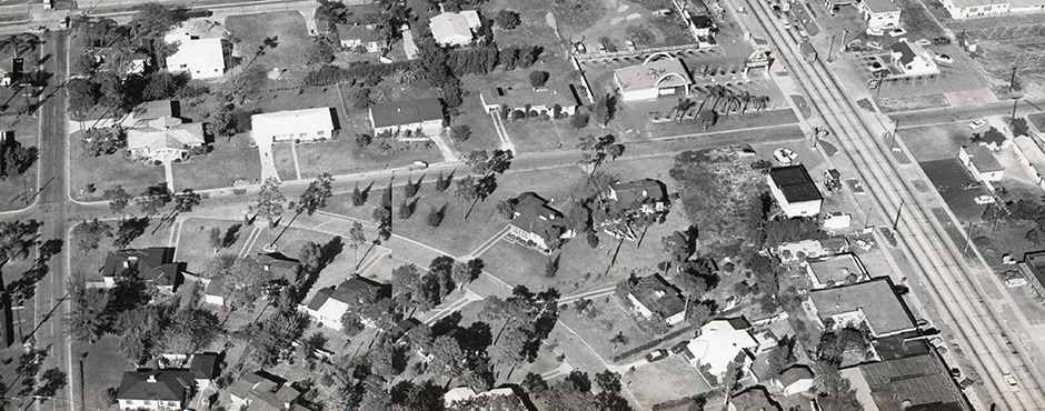
The aerials themselves document the urban growing pains as Tampa’s rapidly changing urban environment required new solutions. These images, as working images, document the many rezonings land use planners were addressing during this time period. The images are approximately 13.5 by 11 inches in size and reflect fine detail. All parts of the City of Tampa, as it existed at that time period, are reflected in these images. Development along Dale Mabry Highway is captured as are many images along the pre-Kennedy Boulevard that was Grand Central Boulevard.
Throughout the City, a wide variety of neighborhoods were documented. Hence, we believe genealogists might wish to take advantage of these photographs. In 2022, the United States Census Bureau and the National Archives will release the original population schedules from the 1950 Census. These historical aerials should provide a nice complement to this data and will be a resource for researchers identifying neighborhoods and households.
Planners and urban historians also might take advantage of these images. They reflect the built environment prior to the creation of the Selmon Crosstown Expressway and document neighborhoods that may no longer exist due to the effects of urban redevelopment and the expansion of the road network. Placing these aerials side-by-side with modern photographs demonstrate how much the landscape has changed in approximately 60 years.
![]()