February 2023 – How do you experience the Fowler Avenue area? Join us on March 2 and 4 for guided walks of Fowler Avenue to witness first-hand the existing qualities, amenities, challenges, and discuss what could be.
Three walking groups will explore a different route. This information will be used to inform the Fowler Avenue Vision Plan.
Please RSVP to Maggie Winter at winterm2@usf.edu with the date, time, and route you are interested in walking, which are identified on the map below. Self-guided walk audits will also be available for those who cannot join the guided walks and will be made available upon request.
Dates:
Thursday, March 2 | 9 am
Saturday, March 4 | 9 am
Meet-up locations are TBD
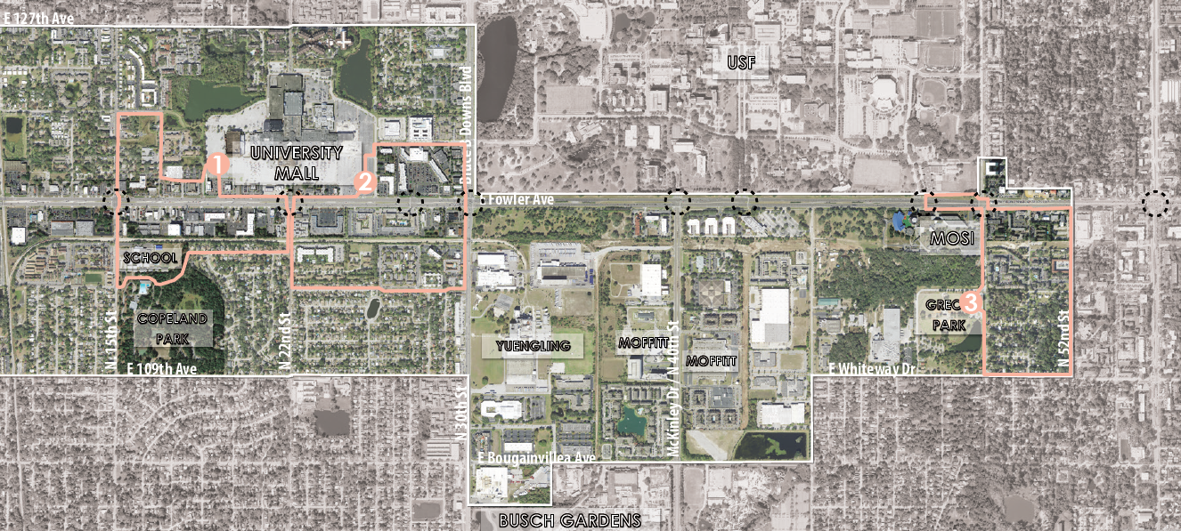
Route 1: This 1.75 mile loop is about a 42 minute walk that crosses Fowler Avenue at N 15th Street and N 22nd Street. The walk takes you through residential and commercial areas on both the North and South sides of Fowler Ave. The route also passes Shaw Elementary School and Copeland Park.
Route 2: This 40 minute walk is a 1.7 mile loop that highlights the commercial areas and new development along the University Mall. The route also provides a good overview of the residential areas south of Fowler and crosses the road at Bruce B. Downs and North 22nd Street.
Route 3: This 1.86 mile loop takes about 48 minutes to complete and provides an overview of the eastern portion of the Vision Study area. This route takes you through Greco Park and residential areas on Whiteway and North 50th Street. Participants will also cross Fowler Avenue using the pedestrian bridge in front of MOSI.
Come walk Fowler Avenue with us. For more information on the Fowler Avenue Vision Study, visit the project page.
Map of routes 1, 2, and 3 (outlined in pink on map)
![]()