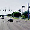
 The MPO board approved the Brandon Blvd/SR 60 study on January 7, 2014, including a number of recommendations to make this busy highway safer and easier to navigate by drivers, bicyclists and people on foot.
The study analyzed traffic and crash data to identify trends and potential areas of concern. Issues identified included:
- Potential increase in freight traffic, due in part to CSX Integrated Logistics Center being built in neighboring Polk County
- High speed limits, notably 50 mph around the I-75 interchange and east of Bryan Rd
- Physical constraints on the six-lane segment between Kings Avenue and Bryan Road and the lack of bicycle lanes there
- Lack of sidewalks west of Grand Regency Boulevard / Brandon Town Center Drive and limited crosswalks at the intersection with SR 60
- Increasing congestion on parallel facilities (Lumsden Road and Bloomingdale)
- High number of crashes at SR 60 intersection with Grand Regency Boulevard / Brandon Town Center Drive
[divider type=”clear”]
Based on forecasts for 2035, traffic volumes on the corridor are projected to grow by nearly 50% in some areas. The study identified parallel local roads that could relieve congestion on SR 60. After close coordination with FDOT, the study makes a number of recommendations, subject to more detailed analysis and meeting state and local standards. Potential enhancements address:
[border padding=”5″ align=”alignleft”]Safety
- A speed study to evaluate lowering the speed limit to 45 mph along the entire corridor
- Narrowing all travel lanes to 11 feet, allowing for more separation between bicycle lanes and motor vehicles
- New traffic signals, including walk signals, on SR 60 at Pauls Drive and Beverly Boulevard, subject to warrant studies
- Modifying the coordinated signal timing and/or an adaptive signal system
- Enhanced traffic signal visibility
- Dynamic message signs[/border]
[border padding=”5″ align=”alignleft”]Connectivity
- Extending existing parallel roads to provide alternatives to SR 60 for local trips
- Additional sidewalk connections on side roads
- A bicycle and pedestrian path on the south side SR 60 to traverse the I-75 interchange
- Designated alternate bike corridors in the area, especially for the portion of SR 60 that doesn’t have bike lanes
- Modifying the configuration of Lithia-Pinecrest Road and Bryan Road to provide better circulation[/border]
[border padding=”5″ align=”alignleft”]Amenities
- A unified signage and wayfinding system for travelers on SR 60
- Additional landscaping, consistent with the adopted SR 60 Overlay District[/border]
[divider type=”clear”]These recommendations are just concepts at this time. More detailed analyses, including environmental and design studies, as well as cost estimating and funding will be necessary before the recommendations can be implemented.
For more information contact Lisa Silva at 813.273.3774 x329.